From a map view to site measurements.
A parking lot measurement workflow that segments asphalt pavement from satellite imagery, estimates area in square feet, and marks detected parking stalls.
Discuss a similar project ↗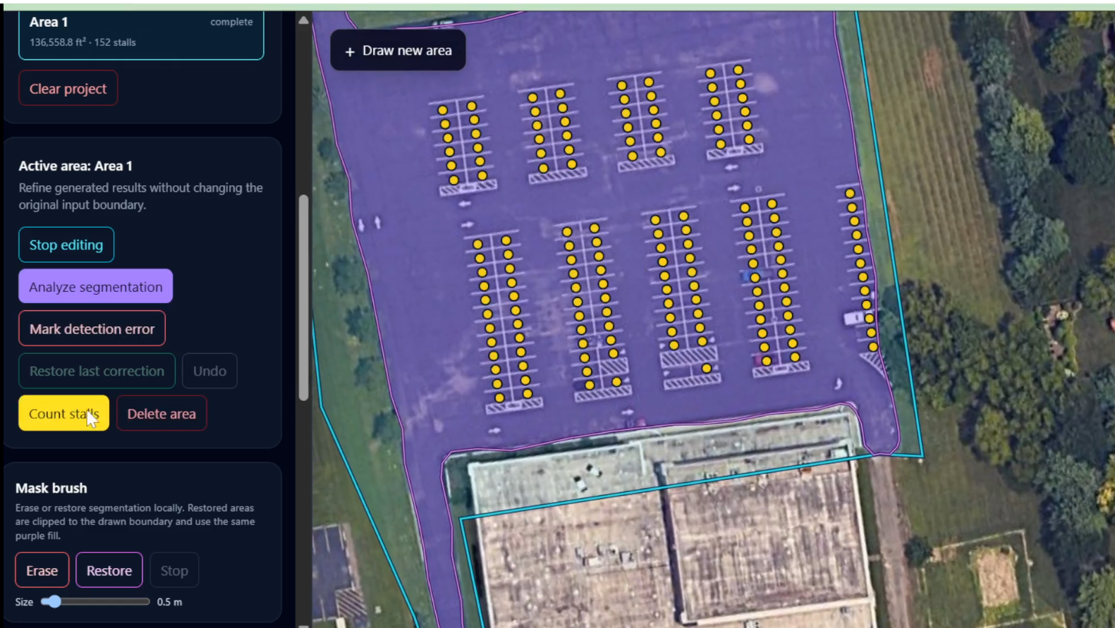
Review pavement area and parking stall counts from a map view, with the detected area and spaces visible on the image.
The problem
An early parking lot review can involve manually outlining pavement and counting individual spaces. Repeating that inspection takes time and makes it harder to compare sites consistently.
The workflow
First, draw the parking lot area on a satellite view. The segmentation model identifies the asphalt pavement and calculates its area in square feet. Then, run stall detection to place a marker on each detected parking space.
The result
The demo presents pavement area, parking stall count, and stall locations together. This gives a faster visual estimate for an initial site review; it is not a substitute for a survey or on-site verification.
Models
The workflow uses an Ultralytics YOLOV26 model for parking stall detection and an RF-DETR model from Roboflow for pavement segmentation.